
General Description
| UN/LOCODE: | UANIK |
| Coordinates: | 46°56’N / 31°57’Е |
| B.A. Nautical Chart No: | 2200, 2201, 2203, 2213 |
| Admiralty Sailing Directions: | NP24 |
| Time zone: | UTC +2 (UTC +3 during Daylight saving time) |
The port joins the sea via the Buh-Dnipro Limanskiy Canal passing through the Dnieper-Buh estuary and Pivdennyi Buh River. This canal starts at Berezan Island and goes on 44 miles to Mykolaiv Port. The canal consists of 13 bends, 6 of which pass through the Dneprovskiy Estuary, and the others through the Pivdennyi Buh River. It is 100 m wide and 11.2 m deep.
Mykolaiv port is navigable all year round. The water in the estuary is fresh. The port’s waters provide good anchorage for large tonnage vessels. In icy periods icebreaker assistance is performed by port’s tugs.
Mykolaiv port is equipped with all means of communication.
The port waters’ total area is 323 ha; port land area totals 69,3 ha.
Mykolaiv river ports
- Mykolaiv sea outer roads
- Dneprobugskiy port
- Olvia port
- Evrovneshtorg terminal
- Nika-Tera terminal
- Okean terminal
- Bunge terminal
- Mykolaiv sea commercial port
- Cofco terminal
- Nibulon terminal
- Mykolaiv river port
Anchorage Areas
Waiting area coordinates – Out of port’s limit (OPL):
- 46°24’10″N / 31°05’00″E
- 46°25’00″N / 31°08’50″E
- 46°23’95″N / 31°09’00″E
- 46°23’55″N / 31°07’15″E
Pilot boarding place – Pivdennyi pilot station (46°33’05″N / 31°01’00″E).
Port Restrictions
Restrictions for all Mykolaiv river ports:
- Official max LOA 215 m
- Max beam 32,5 m
- Max draft in channel 10,3 m FW
- Max draft at berths 10,3 m FW
- LOA > 215 m – port call is possible with Harbour Master / channel authority special permission
- LOA > 200 m – no night traffic via the channel
- LOA > 187 m – escorting tug needed for day & night traffic via the channel
- Max draft > 9,99 m FW – escorting tug needed for day & night traffic via the channel
- Max draft > 8,00 m FW – escorting tug needed for night traffic via the channel
- Channel traffic/entrance prohibited during fog, mist, snowfall, heavy shower and other conditions when leading beacons or leading lights are not well visible and in case wind speed exceeds 15 m/sec
Salinity: 1002 – 1004.
Tide
No tide fluctuations
Weather Restrictions
In the cold period of the year, from November until April, N, NE, W, NW winds prevail, and from April till October, NE, S, SE winds do. The average monthly wind speed is 3–6 mps. In the cold period, wind speed of 15 mps and more tends to prevail. Fogs are mostly observed from October until March, with the average monthly number of foggy days ranging from 4 to 12. Visibility in port’s entrance canals and waters extends to 5–10 miles and more.
Mykolaiv port’s waters are not protected from winds – that is why small vessels cannot take shelter there. As a result, in case of S, SW, SE winds, captains of such vessels should take the necessary precautions.
In winter time traffic through the approaching channel is permitted only in convoys escorted by an ice-breaker. Ice period normally lasts from the beginning of December until the first half of March. Passing through the approaching channel is permitted by day time only. On announcement of Ice Campaign (if ice thickness exceeds 5-10 cm), traffic through the channel is permitted for vessels having an Ice Class certificate and a Special Guarantee Form signed by the Master, which is to be submitted before entering ice.
Entering the channel during fog, mist snowfall, sea evaporation and under bad weather conditions, causing restricted visibility of navigation aids, is prohibited.
Working Hours
Port operates 24/7 all year round.
Services
- Bunkering only at outer anchorage
- Fresh water supply by barge
- Crew changes
- Provisions & stores supply
- Garbage disposal
- CTM
- Diving Inspection
- Repairs
- Holds cleaning and fumigation
Ballast Waters Requirements
According to MARPOL and the State Environmental Inspectorate of Ukraine Regulations, all ballast should be changed in Black Sea before arrival at deep part of Black Sea and outside of the exclusive economic zone of Ukraine. The exchange must be recorded in ships’ official logs. Subject to appropriate request prior to arrival, the Master has to declare to Agent quantity of ballast water that he intends to discharge in harbor for the cargo operation.
Maximum permissible concentration of main pollutants in internal sea waters and territorial waters of Ukraine:
- Suspended solids, mg/cu. Dm – 2,0
- Salinity, g/cu. dm – 18
- Oil, mg/cu. – 0.05 dm
- Iron, mg/cu. dm – 0.05 dm
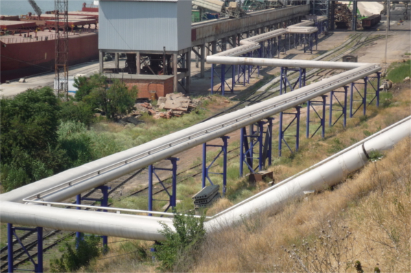
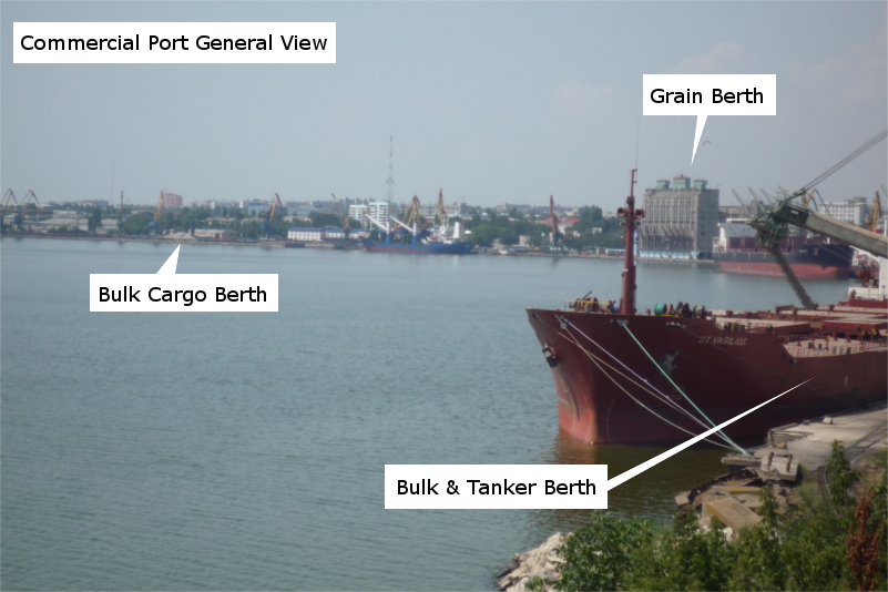
Photos